After month of planning to start our Colorado Trail (CT) hike, here we are starting our first segment in the morning of June 15, 2012. Our friend, Dave Graham, was kind enough to drop us off at the Indian Creek Trailhead 10 miles west of Sedalia. Nothing is better in return of Dave's kindness than a bottle of Jack Daniels for his service!! We hike with our dog, Cooper, so we have to hike from alternate route instead of starting at Waterton Canyon.

It was a great weather to start off our hike. Our hike start approximately 7,100 ft elevation and first mile mostly down hill easier part for the start. It was pecfect hike in the wood with some creek crossing, lots of state flower, columbine blooming already.
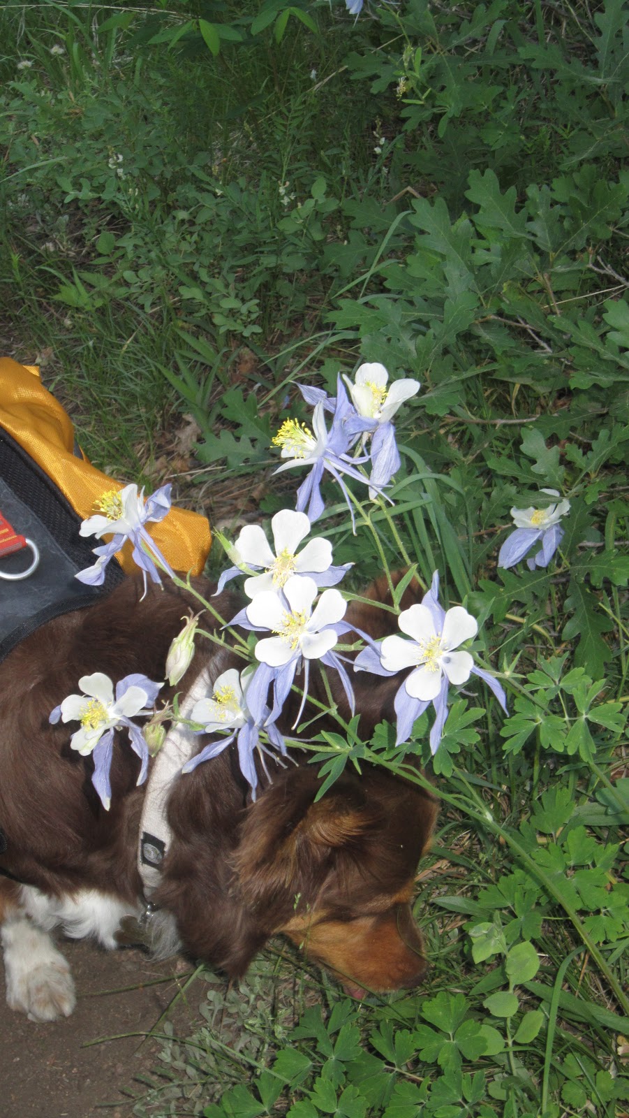
Cooper nose into picture.

Colorado flower-Columbine

Hiking through rolling hill and some good shade on this first 2 mile of this trail.

This is a junction at 2 miles in. Sign on the left is hike toward Indian Creek TH and sign on the right for route toward CT.
After this 2 mile mark into 3rd mile, trail start climbing up approximately 500 feet making up for first 2 miles down hill. We ran into a couple of moutain biker during this segment. We love early hike on this weather and less crowd on this trail. I can see how crowded it would be on this trail on the weekend.

Excuse for picture time to take a break, Brad and Cooper.

Nice day, blue sky such a great view into our mile 3

At 3.5 mile mark junction where CT junction continue on the left and Indian Creek Trail#800 on the right.

Continue our hike from 3.5 mile mark, we have approximately 1 mile to the Lenny's Rest which is junction we will meet main CT at mile 7.9 from Waterton Canyon.

We made it to Lenny's Rest and memory for Eagle Scout Leonard Southwell who die at age 18.

Perfect place to take a quick break. It took us 2 hr for 4.4 miles at this point.

Continue on toward Bear Creek which it was noted to be close to last spot to get water and good campsite at mile 8.7 or mile 5.3 from Indian Creek TH.
It's obvious now that our originally plan wasn't going to work to camp near Bear Creek since hiking from Indian Creek TH is 3.5 mile shorter than from Waterton Canyon. We were joking that Cooper did give us good advantage since it's prohibit to hike with dog from Waterton Canyon, so we had less hike to do. Thanks to Coop! To bear creek area, we would only hike for 5.3 miles and only 3 hr in. We were feeling good to continue on hiking and possible push it to finish in a day. We reached bear creek area and there are several nice campsite by creek. Unfortunately we didn't take picture of it and now regret after we ran into fellow hiker, Allen from Illinois. He plans on a thru hike to Durango for his 50th birthday. He started a day before us and camped at one of site in bear creek area. He got up and found bear trying to get to his food he hung on the tree. He blew his whistle to scare it off and it worked. But this bear did come back and very persistance to get his food. He had to scare him off several times and pack his stuff very quickly and started his early hike! He did say there was a note on card board by previous hikers on the other camp site in the area that 6/5 there was bear stolen their food and not afraid of human. Well we were sure then not camping there that night!

Trail continue to climb up after bear creek. We still have plenty of water, so we didn't refill our water. But still debating that book mention at mile 10 (7.5 from Indian Creek) there was another small creek for water source.

Rattle snake I encounter on the trail. I screamed and jumped. It didn't really rattle though.

Still keep climbing up!!

Reaching mile 10 (7.5 from Indian Creek TH) or so, taking a quick break in the shade and we heard water sound. We were so happy, yes!!! We refill out water about 4 litter worth and Allen from Illinois caught up with us at this point as well. Now we do have option either still continue to camp tonight or finishing up in one day.

This is at CT mile 11.8 or mile 8.3 from Indian Creek TH about 7,309 feet CT climb up from the right of picture and this is another good camp spot. Take another break to rest our leg and shoulder. By this point, my shoulder is getting sore from my pack!

This is another great spot on this trail that I didn't really see anyone mention. Trail keep climbing up to this point you will notice big rock formation and there are several camp spot that had been used here and camp fire set up. It's about It's close to be a highest point on the trail and with 180 degree view. This picture shows high peak in distance for where Waterton canyon is.

Cooper is posing and enjoy this view too. Brad hurt his knee a little bit and we took a break here. Brad put his knee brace on and hopefully it will help on any downhill along the way.

We reached the highest point of this trail at CT mile 12.6 or mile 9.1 from Indian Creek TH at 7,517 feet. It's sad to say that it's great view which view of Hayman fire destroy forest in 2002. When we reach this point, we had been hiking for 6 hr for today.

Our camp spot for tonight!

We decided to set our campsite after the highest point approximately at CT mile 13.1 or mile 9.6 from Indian Creek TH and it's about 7,310 feet.

Cooper is so tired and just fighting not to take a nap like any of us! He had been guarding us (at least that's what he thought he did) outside tent.

Another great view overlook of hayman fire in 2002. This is also another campsite with great view about 50 yards from where we camped. We felt that it was little too expose and a lot of lighting trace on surrounding dead tree. We cook our dinner and walked over to had dinner here around 7pm.
So far on first day of this hike, we ran into a couple bikers and 2 thru hiking for CT. Beside Allen, there is another person caught up with us while we set our tent. I later was told by Allen that he was from NC and was a professional guide. Also our friendly biker and full of information and share this trail with us is Bob from Ken Caryl Valley area. He surely is a hard core biker and very nice guy.
We got some sleep on and off during the night. It was so windy all night long and we were so glad we didn't camp at the other camp spot. Cooper was spooky all night. Brad and I kept waking up to calm him down.
Next morning we had our friends, Bill & JungSook and their little girl Selina Jennings, who planned to hike up from end of segment 1 (South Platte River TH) to meet up. Believe it or not, where we camped, there was cell service and Brad txt them to let them know we were about 2.5-3 miles in from their end.

Packed and fresh start in the morning ready to hit the trail and meeting up with the Jennings Family.

Here she is...Selina, we met up 50 yards down!

Here is Jennings Family. Hiked up to meet us on this trail!

Group picture!!

Here is our picture..
After catching up and picture time, it's about 3 miles left for this hike. It took us about an hour to get to the end of this segment. It's all down hill and shorter route that my sore shoulder felt fine today. Brad's knee wasn't hurt either day. It's great all around.

Lots of cactie on this part of trail.

Finished our hike by cooling off in the South Platte River. This is also the start of segment 2 CT.

This is our elevation information based on GPS watch which actually ran out of battery at little after the hightest point on this route..approximately after CT mile 12.8 or mile 9.3 from Indian Creek TH.

Direction:
Getting to Indian Creek TH: Drive south or North on Santa Fe drive, turn to CO67 at town of Sedalia. Continue west for approximately 10 miles to Indian Creek TH parking lot. TH start off the far west through campground.
Getting to South Platte River TH: For end of segment 1, drive south on Hwy 285, pass Aspen Park and Conifer. You will pass all shopping center and there is sudden turning right lane after you pass Conifer, look for Reynold Park sign. Turn right to get off Hwy 285 and turn left which will be come CR97 or Foxton Rd. It will go underneath Hwy 287 curve right to 3 way stop sign. Turn left toward Reynold Park (which is CR97 or Foxton Rd). Continue on this road for 8 mile. There is intersection you will see area map for South Platte River Corridor. Turn left which will be CR96 (no stree sign). Continue on this road along river (on your right) for 5.5 mile you will across the smaill bridge - which ghost town of South Platte is. Once you cross this bridge, it become CR97 and TH parking lot is on your right about .5 mile from the bridge.
Getting to South Platte River TH: For end of segment 1, drive south on Hwy 285, pass Aspen Park and Conifer. You will pass all shopping center and there is sudden turning right lane after you pass Conifer, look for Reynold Park sign. Turn right to get off Hwy 285 and turn left which will be come CR97 or Foxton Rd. It will go underneath Hwy 287 curve right to 3 way stop sign. Turn left toward Reynold Park (which is CR97 or Foxton Rd). Continue on this road for 8 mile. There is intersection you will see area map for South Platte River Corridor. Turn left which will be CR96 (no stree sign). Continue on this road along river (on your right) for 5.5 mile you will across the smaill bridge - which ghost town of South Platte is. Once you cross this bridge, it become CR97 and TH parking lot is on your right about .5 mile from the bridge.