Introduction

Welcome to my blog. I have idea to create this blog to share our plan on hiking the Colorado Trail which approximately 468 miles from Denver area to Durango, Colorado. Beside the official quidebook of the Colorado Trail Foundation, we read some blogs about this trail to prepare for our hike and gather information. I thought it wasn't a lot out there as I thought it should have been. I thought I should share our story with anyone who may be interested to hike this trail or thinking about it.

Sunday, August 26, 2012

Segment 4

Our hiking plan started with driving both of our cars on the same day we hiked. It took us about 2 hours to drop our car off at the end of segment 4 and back TH to start our hike at Rolling Creek TH. It was a very nice cooler day and great weather for hiking. By time we started our hike it's about quarter after 11am on Friday 8/24/12. We planed on an overnight backpacking on this segment. Total of 16.6 mile for 2 days.
 
Rolling Creek TH which this hike will go through Lost Creek Wilderness. We had to register our info
 
At Rolling Creek TH parking area, there are 2 main TH junctions, one side is on a southwest side which hike through wilderness and CT TH is on the northeast side.
 
We were ready to go!
We reached mile 1.9 where we started hiking in Lost Creek wilderness
 For bikers there are alternate route which detour about 24 miles because biking is not allow in wilderness. It's explain in CT guide.  We won't be experience any biker on this segment unlike first 3 segments which are very popular for bikers. First 4 miles of this hike is gradually incline through thick forest with mostly spruce and pine, then change to thick aspen forest. It's quite a change from previous segments.


Looks like we hiked through well maintain garden/forest really
Resting at mile 4.5, first water source we could refill. We hiked about 2 hrs so far
Approaching mile 5.6 gradually climbing up
Interesting? Nature or man made? Both?
What a great view through open meadow..after 8 miles hike
Relaxing and first time we really saw some sunshine

We took our time to enjoy and relax
We were getting close to where we planned to set our camp for the day. It should be about 1.5 mile to to. We haven't seen anyone on this trail so far until we were getting ready to hike again. There was an older couple with Goldendoodle hiking by. They were planning on hiking both segment 4 and 5 in 3 days. Once we hiked, we saw them set their site around mile 8.9 where junction trail of Brookside-McCurdy and to Lost Creek CG. There were creek and lots of campsite in this area and able to come  from other trails in this wilderness. It was great spot for sure. We continued pass that through mile 9.3 or so and there was a great camp site and later found to be last site or having to hike to mile 11-12 for next camp site.
View from our campsite toward our destination the next day
Cooper was guarding between us while I was setting up our sleeping bag and padding inside and Brad was filtering water by creek below
Not too bad for our home for tonight
Filter and refill our water for cooking our dinner and drinking water
View from where we hiked from to where our campsite
Chill time after dinner


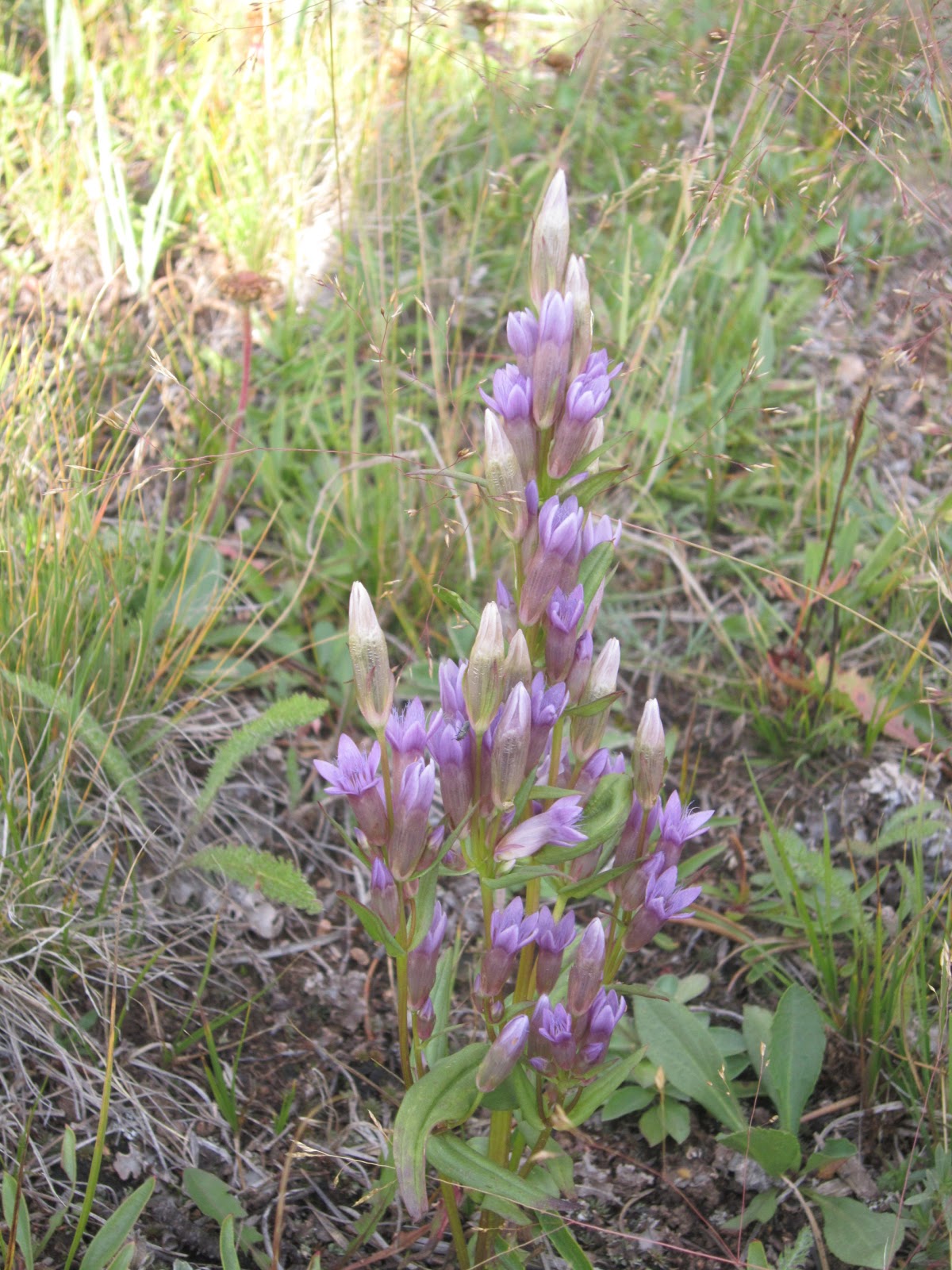
Some of wild flowers on this trails still bloom in this late summer
2nd day and ready to hit the trail to finish up this segment. Great morning and clear sky. We had about 7.3 miles left to hike today.
 
We continued next 5 miles and had similar view hike through meadow. It didn't seem like it ever going to end. It was a little easier hike compare to elevation we had yesterday. It's more meadow hike with some up and down hill. But since it's 2nd day, any little hill seem a lot to concur!!
At this point we were about mile 14.4 started hiking through forest again.


About mile 14.6 reached this rock form and great view. Last stop and 1.1 mile to go to finish our hike
 
We did it and this is view from the end of this hike. We finished 2nd day 7.3 mile in less than 3 hour. Total of 16.6 miles and approximately 3,200 elevation gain.
 
Direction:
Getting to FS Rd560 (Wellington Lake Rd) TH or Rolling Creek TH: Drive south on Hwy 285 to Bailey. Turn left in town of Bailey on Park County Rd 68. This is a pave road for a mile, then it turn to gravel road. It's not required a 4x4 vehicle to drive on this road. Continue on this road and it will turn to FS Rd 560 for 6 miles then you will reach Y junction. Continue on your right for approximately 1.5 miles, see small parking area on your right and sign for Colorado Trail. Turn right and continue driving up road to parking lot for segment 4 trailhead.
 
Getting to end of segment 4 or beginning of segment 5: Drive south on Hwy 285 to Kenosha Pass and continue pass approximately 3 mile down, turn left on Lost Park rd there is sign on your left side for your left turn. Continue on this road for approximately 11 miles you will see a little pull off on the left for wooden sign for FS road 817.  Drive up this road for .2 mile and lower car can make up this road to TH and parking area. There is also campsite by parking as well.  Before you get to this TH, about mile 7, there is also another small road you will see sign for Ben Tyler TH and CT. Don't turn there, it's not start of segment 5 or end of segment 4. But you can get to CT from here, but only get you half of trail for your hike or mountain bike the rest of segment 5 from here.


Friday, August 10, 2012

Segment 3

We decided for another day hike on this segment. We drove and parked our jeep at the beginning of segment 4 on Friday 8/3 evening. Parking area seems pretty safe and already had several cars there.  We left home not as early as we did on segment 2. We arrived to Little Scraggy TH at 8am. As always cooper is so excited for outdoor activity, but he has no idea how long it could be on this hike and not that he care! This morning was a little colder and temperature was around 55 degree when we started. Perfect temperature for coop. We did hear some gun shot  already even by trail head. It did spook cooper to look around. We know it's going to be a long day with cooper reaction and anxiety since we would have to hike  rifle club in the area along trail toward the end.

Let's hike!
After  half mile into hike, trail across FR road 560 which lead toward back country and great campsites in this area.
Great morning and great view
About mile 1.9 there is a trail junction to Shinglemill bike trail
Keep on hiking on CT


what a surrounding view
I got to mark where we hike and making sure we were not lost.
we were at mile 5.6 at junction of Tramway bike trail.
At another bike trail junction call Green Mountain about mile 6.3

Up to this point of hiking, we were about half way done and about 11am. We only met on hiker on this trail whose hiking name is Tikka. He seems like a very nice guy and hike around the world. He hiked through from segment 13 down to segment 1 on CT, He hiked continental divide and bike cross country. He planned to finish it by Monday which he planned to meet up with his friend's friend in Parker. He had 2nd thought that he might be able to finish it by Sunday night. We offered to him that we could swing by around 6pm if he there and took him to where he need to be. Well Sunday night came, we totally forgot to drive to check on him and who know if he made it that evening. Guess what I was driving on Monday out of our neighborhood, he was walking along Wadsworth toward C470. Forgot to mention we live not far from waterton canyon which started of segment 1 where he had to finish back. I drove back home, told Brad that I saw Tikka walking, we need to take him to where he needed to be. I felt bad for last night we forgot and what a chance I ran into him again. We all drove out include Coop and he was resting underneath the highway bridge of C470 and Wadsworth.  He was surprised when he saw us pull over and offer him a lift and called person who he supposed to meet in Parker. We drove him to Parker Library where he would be picked up.  It's pretty crazy. Even though we forgot about him, we did get to help him on his journey!

The rest we met on this trail was all bikers. So far up to this point, where in CT book mention for creek crossing, it was not much of a creek or water to really filter for drink.
At mile 7 it's junction for Buffalo Creek campground
Cooper still looked good for more than half way through this segment

Reaching the country road which led to the Meadow campground at mile 7.6


CT this way
At mile 8 it's only reliable source of water on this segment where Buffalo creek is
Official sign for riffle range nearby around mile 9

We had heard gun shot all around us most of this hike. It was sure really loud and quite often in this area. Felt like a walking target on this trail. Cooper was doing pretty well even though he was spook with gunshot sound. He seems to learn to get used to it but still a little scare. It was a training..
We were getting so close to be done. Main road junction to parking lot ahead of us!

Last stretch to parking lot end of this segment.


 Our GPS information for our route for 12.5 mile and approx 1600 ft elevation gain.


Direction:
Getting to Little Scraggy TH: Drive south on Hwy 285 approximately 32 miles to Pine Junction. At traffic light, turn left on Pine Junction road or Jefferson County Rd (CR) 126. Drive on CR12 for approximately 13 miles, turn right on FR550. For a short drive after your turn, there is parking lot at Little Scraggy TH. It cost $6/day for parking here.

Getting to FS Rd560 (Wellington Lake Rd) TH: Drive south on Hwy 85 to Bailey. Turn left in town of Bailey on Park County Rd 68. This is a pave road for a mile, then it turn to gravel road. It's not required a 4x4 vehicle to drive on this road. Continue on this road and it will turn to FS Rd 560 for 6 miles then you will reach Y junction. Continue on your right for approximately 1.5 miles, see small parking area on your right and sign for Colorado Trail. Turn right and continue driving up road to parking lot for segment 4 trailhead. This is end of segment 3.